
Ada County ZIP Coverage Roster
Ada County research uses a 34-route operational roster: standard delivery codes for Eagle, Kuna, Meridian, Star, Boise, and Garden City, plus post-office-box and unique institutional routes. The area labels below are orientation, not legal boundaries. USPS delivery data controls the mailing result for an exact address. Ada County GIS helps test parcels, municipalities, and an approximate ZIP layer. Keep the postal city, situs city, municipality, and county in separate fields.
| ZIP Code | Areas Covered | Post Office | Notes |
|---|---|---|---|
| 83616 | Eagle and north Ada | Eagle | Check municipal and postal lines separately |
| 83634 | South and southeast Ada | Kuna | Standard street delivery |
| 83642, 83646 | Central, southeast, west and northwest Ada | Meridian | Two broad standard delivery areas |
| 83669 | Northwest Ada | Star | Standard street delivery |
| 83702-83706 | Downtown, North End, west, Bench and southeast Boise | Boise | Standard codes in this run |
| 83708-83709, 83712-83713, 83716 | Boise standard routes from southwest to foothills | Boise | Use exact-address validation |
| 83714 | Garden City and river corridor | Garden City | Postal and municipal labels can diverge |
| 83680, 83701, 83707, 83711, 83715, 83717, 83719, 83799 | Box routing only | Meridian or Boise | No street-area conclusion |
| 83720, 83722, 83724-83726, 83728-83729, 83732, 83735, 83756 | Institutional destinations | Boise | Unique routing, not a neighborhood |
The institutional group includes routes associated in the researched roster with the Idaho State House, tax offices, the Federal Building, Boise State University, Boise Cascade, and other single entities. Confirm the current holder through USPS before relying on the label. Nearby Melba, Murphy, or Nampa codes may appear in county-overlap datasets because ZIP and ZCTA products use different geography. Their presence does not put every delivery point in Ada County.
Ada Standard ZIP Code Routes
The Ada County ZIP code directory begins outside central Boise. Eagle's 83616 points toward north Ada, Kuna's 83634 toward the south and southeast, Meridian's 83642 and 83646 divide broad central and western service areas, and Star's 83669 marks the northwest. These are useful first filters, but none should replace a parcel or city-limit check. Growth and route changes can leave a familiar postal city attached to an address that falls under another local government.
Boise's standard set is more granular. The roster orients 83702 toward downtown, the North End, and central north; 83703 and 83704 toward northwest and west Boise; 83705 toward the Bench and southwest; and 83706 toward southeast and central-south Boise. Codes 83709, 83712, 83713, and 83716 extend into southwest, east, northwest, and foothill areas. Research by ZIP should preserve the full street number, directional, street type, and unit so the postal code does not become a substitute for the address.
Garden City ZIP 83714
ZIP 83714 is a local geography warning in one row. The postal label is Garden City, and the route follows the Garden City and river-corridor orientation. Yet Boise labels, Ada County records, and broader Boise-area references may appear close by. Garden City is a separate municipality. A mailing label does not decide which city clerk, planning office, permit system, or court record holds a local file.
The same distinction appears in historical sources. Idaho State Archives directory catalogs include Garden City within Boise-area directory holdings even though the municipal boundary remains separate. When a directory entry, parcel card, and USPS result use different place labels, retain all three with their dates. That mismatch is evidence about record systems, not an error to smooth away.
Note: Compare the current city-limit layer before sending a records request, since a Garden City postal route may not select the right municipal custodian by itself.
Ada ZIP Lookup Search Fields
The USPS ZIP Code Lookup supports three useful paths: an address query, a city-and-state query, and a cities-by-ZIP query. The address form preserves Company as optional and asks for Street Address, Apt or Suite, City, State, and ZIP. Its standardized result is the best public check for one delivery point, but USPS expressly warns that a result does not confirm a person or business at that address.
| USPS mode | Fields supplied | Best use | Do not infer |
|---|---|---|---|
| By address | Company, street, unit, city, state, ZIP | Standardize one delivery point | Current occupant |
| By city and state | City and state | List associated ZIP routes | Municipal boundary |
| Cities by ZIP | ZIP | Check accepted postal city labels | County membership |
| AIS Viewer | Address and postal product context | City, county and delivery-type research | Open bulk person list |
The current search paths are visible on the official USPS lookup.
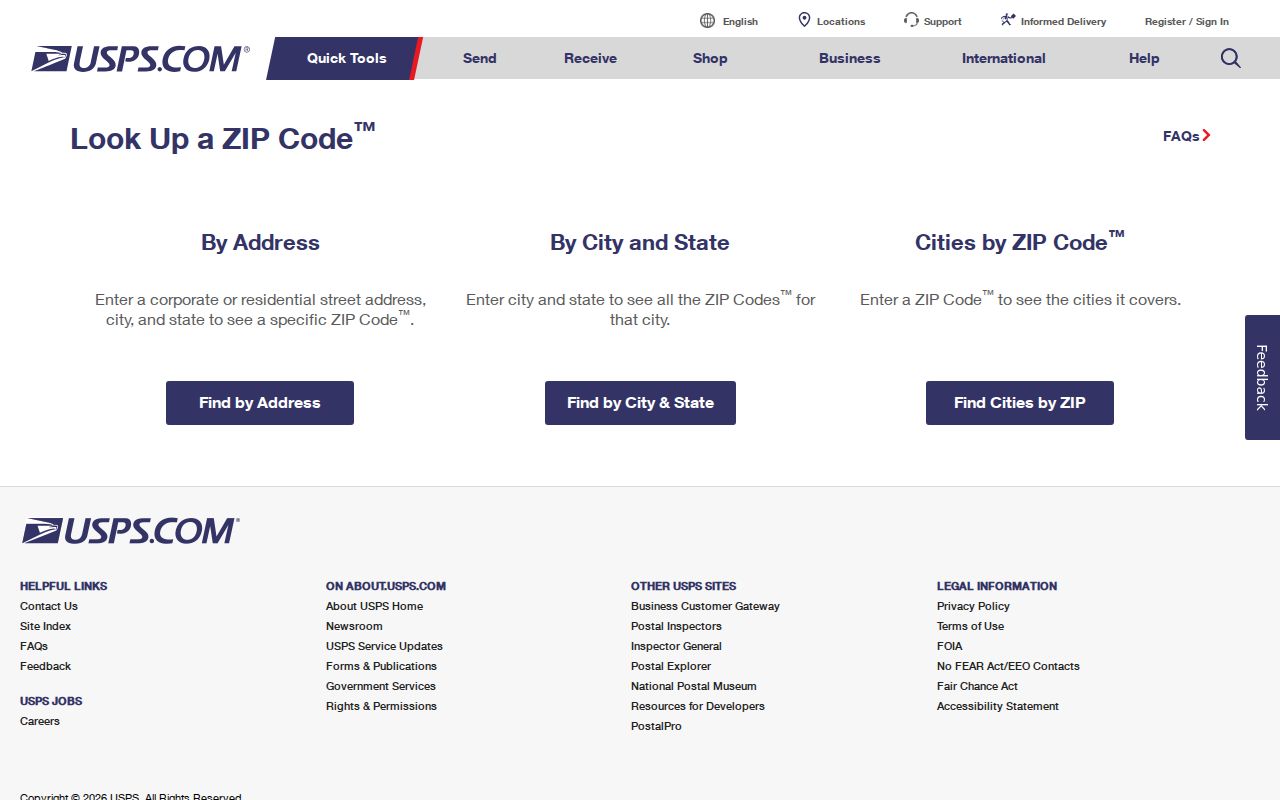
The captured interface shows why an exact Ada address is more useful than a broad ZIP search: street and unit fields let USPS return a standardized delivery result.
Ada ZIP Data and AIS
The USPS AIS Viewer describes city, county, post-office, ZIP, and address-quality data with a monthly update cycle. Some detailed postal products require gated access, and the City State Product is distributed through an encrypted product route rather than an open bulk download. That makes the public lookup the practical tool for one address, while AIS documentation explains what the postal fields mean.
The AIS description used for the Ada County ZIP code directory can be checked at the source link above.
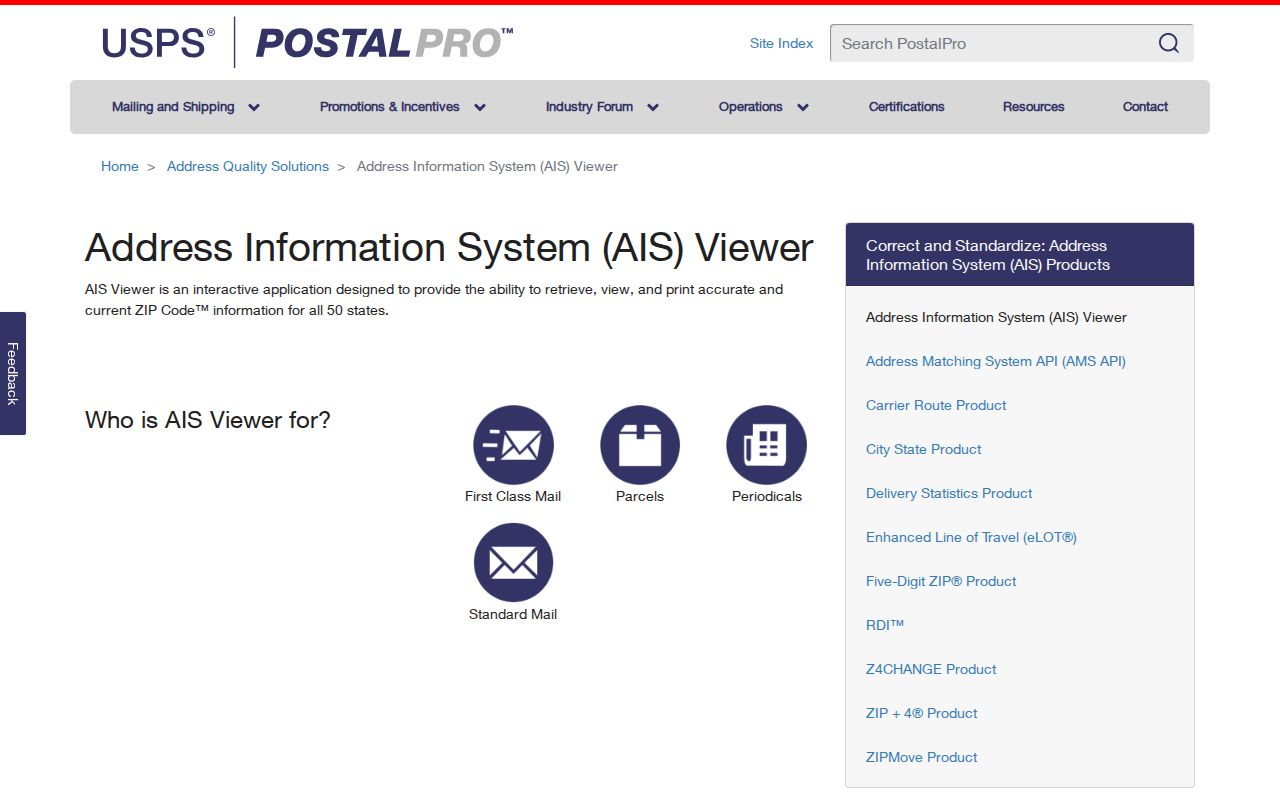
The screen supports a key distinction: postal products are maintained routing data. They should be paired with Ada County parcel and city-limit layers when the question concerns jurisdiction.
Find Ada Residents by ZIP
Few official Ada systems allow a broad resident search by ZIP. The assessor's public lookup has Address, Parcel, and Subdivision tabs, not an observed ZIP tab; a parcel card displays the situs ZIP only after an address or parcel has been found. The GIS viewer offers an approximate ZIPCODES layer. Idaho's public voter form verifies one person using name and date of birth, while the captured state voter-file order form uses statewide, congressional, or legislative scope rather than a ZIP filter.
- Copy the complete address, including unit and directional fields. Run USPS and save the returned ZIP, postal city, county, delivery type, and lookup date.
- Search the Ada County Assessor Property Lookup by address. Open the parcel card and retain the situs, parcel number, selected year, and legal description.
- Compare the parcel with the Ada County Assessor Interactive Map. Turn on ZIP approximation, city-limit, parcel, and relevant subdivision layers.
- Use a ZIP filter only in a portal that actually offers one. The Idaho State Police registry has ZIP mode; some Boise permit modules expose ZIP, but they cover city records only.
- Record every mismatch. Do not rewrite a postal city, parcel situs, or municipal jurisdiction merely to make the fields agree.
Once the ZIP and parcel are confirmed, the Ada County street directory carries the search to the named street and its address-keyed records. That division matters because a ZIP-wide result is too broad to identify a household.
Unique Ada ZIP Codes Explained
Ten Boise codes in the roster are unique routes: 83720, 83722, 83724, 83725, 83726, 83728, 83729, 83732, 83735, and 83756. Several have researched institutional associations, such as the State House, Boise State University, tax offices, and the Federal Building. A unique ZIP can reveal an agency or campus routing relationship. It cannot identify a neighborhood or resident, and an old institution label needs current USPS verification.
Post-office-box routes pose a different limit. Meridian 83680 and Boise 83701, 83707, 83711, 83715, 83717, 83719, and 83799 route mail to boxes. They do not describe a street situs. When a record contains only one of these ZIPs, look for a parcel address, case venue, business file number, or other role-specific location before assigning geography.
Ada ZIP Codes vs City Limits
ZIP polygons, Census ZIP Code Tabulation Areas, city limits, county boundaries, neighborhood polygons, and parcels answer different questions. The Ada GIS ZIP layer is labeled approximate USPS geography. A nearby county-overlap list may include Melba, Murphy, or Nampa because some mapped ZIP geography crosses boundaries. That does not place every delivery point in Ada County. For records work, the parcel and city-limit layers identify the likely local custodian, while USPS confirms routing.
Ada County's own address system adds another layer. Its four directional grids radiate from a central point, and numbers rise outward. Preserve predirection, street type, and unit when checking a ZIP. A changed or normalized street address may explain why an old directory and current postal result differ. Postal routing can change even when ownership does not.
- ZIP vs ZIP+4
- A five-digit ZIP identifies a delivery area; the extra four digits narrow mail to a smaller segment or destination.
- PO-box ZIP
- A code used for post-office boxes, not a defined residential street area.
- Unique ZIP
- A code assigned to one high-volume institution or agency rather than a neighborhood.
- Carrier route
- A postal delivery path within a ZIP. It is a mail operation unit, not a city boundary.
Keep boundaries separate. A postal label can guide an Ada County ZIP lookup, but only the matching parcel and jurisdiction layers identify the responsible local office.